|
||||||
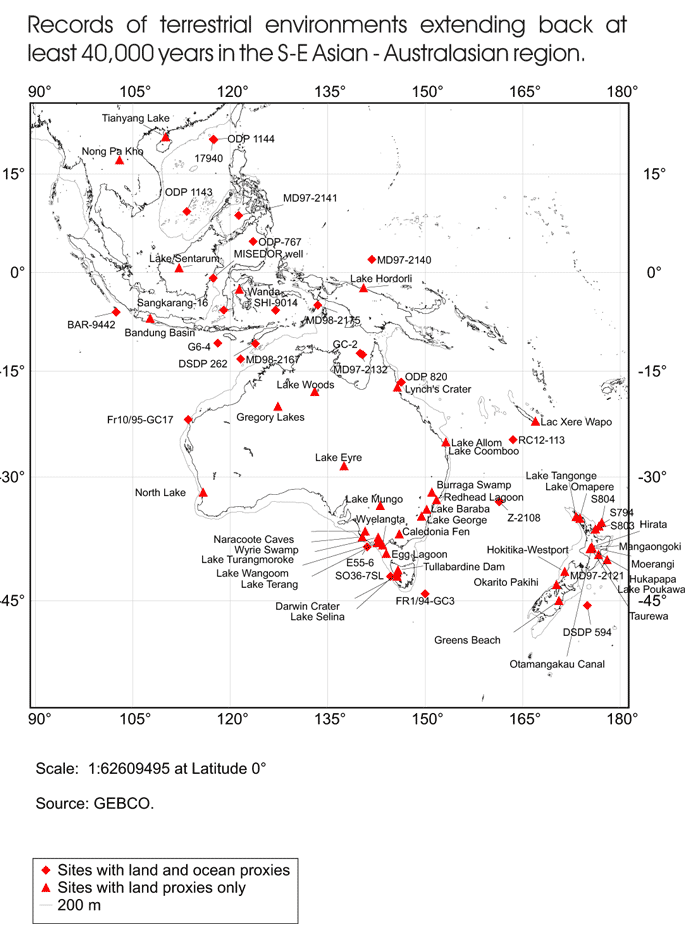
MapsAnother component of the project involved mapping the sites in the database. In the map below, red triangles represent terrestrial records covering at least the last 40 ka and red diamonds represent sites containing both land and marine proxy records.
|