Puna, NW Argentina, October 2018
|
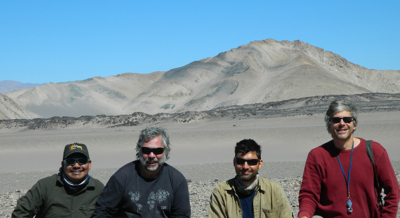
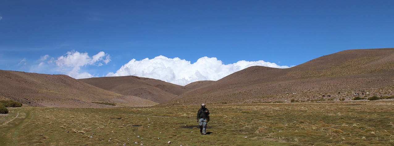
Arrival at La Hoyada (in 2017) and Cerro Negro over 5000m in the background |
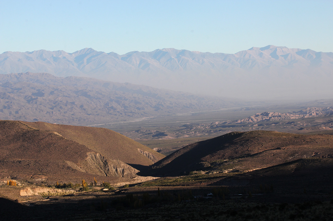
La Hoyada seen from above, looking SE towards the planes and the southern tip of Sierra de Quilmes and Aconquija in the background. Dust storm on the planes. |
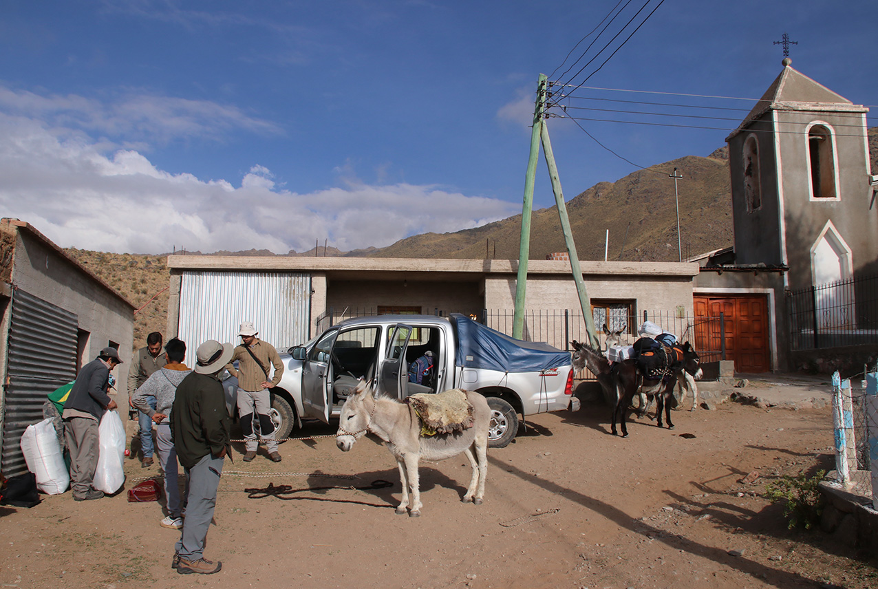
Getting ready in La Hoyada close to the church |

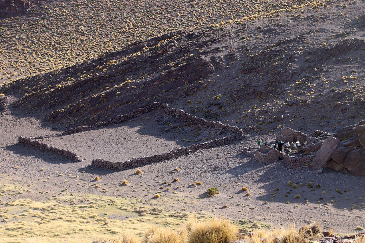
Typical puesto on the way to Dona Dionisia (familia Pachado Guanco), over the ignimbrites that form the smooth surface at La Hoyada |
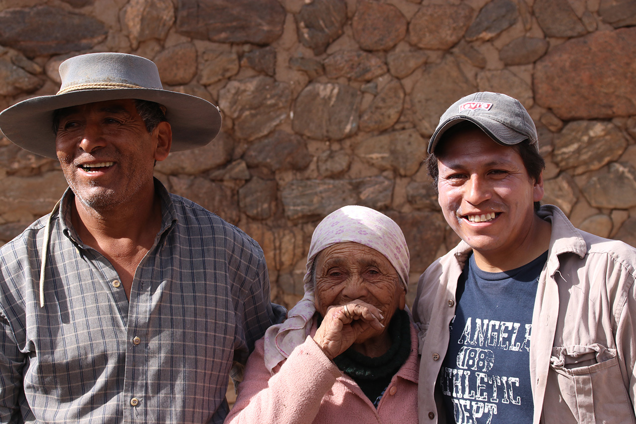
Dona Dionisia and grandson and another relative |
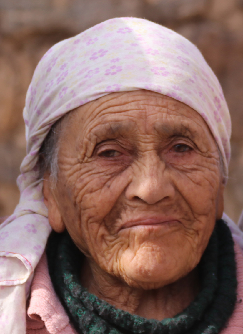
Dona Dionisia |
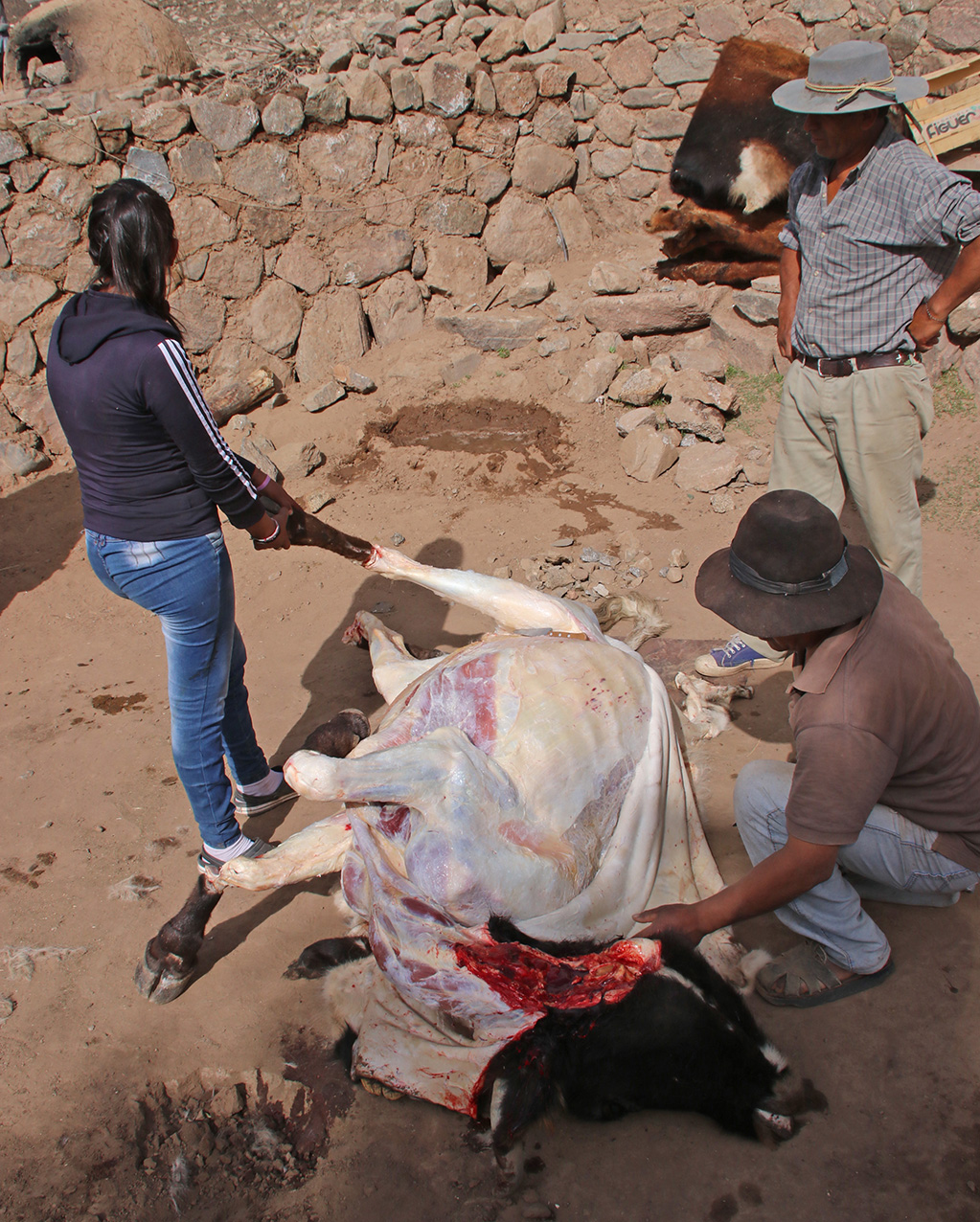
Skinning a bull |
Puesto Lagunita: the first puesto on the plateau proper, where recent rhyolites lie over the Famatinian granites of the Easatern Eruptive Belt |

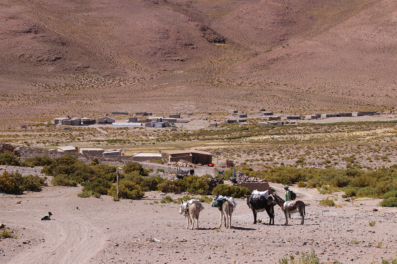
Loaded donkeys at Puesto Lagunita. |
Puesto Macho Muerto (ruins) on ignimbrites: we spent the third night here, temperatures below freezing (end of October) |

Abra de Pendencia S26 24 52.6, E66 31 58.7, 4228m |
After this place we got separated: Nestor and Alfonso went back down from the pass to find the lost GPS, I continued with the two guides and horses.
They went down a lot faster than I did because I was looking at the rocks. By the time I got to an bifurcation in an open grass fields with water they were not
there. I could go down to a major valley or up away from it.
I had seen two people going down but from a distance could not see the donkeys with them. Given that we had seen a total of one family and four other people in four days, I though
this was them. Not only that, but I also recognized the foot marks left by their shoes, but wait - the two people were wearing shoes with the same pattern, unlike our two guides,
which were different shoe types. Something was wrong. I called out for them to wait, but they were too far ahead going down. When I reached the main valley they had slowed
down going up the hill on the other side. I called out again, they heard and came back down. They were a teenage girl and a younger boy. They said they had not
seen the guides and donkeys, and that their puesto was further up from the bifurcation. So I returned, not quite understanding where they had gone. I waited at the
bifurcation until Nestor and Alfonso arrived back, having found the GPS. We then went to the Puesto as it was already past 5 pm (sun set at 7:30 to 8 pm). Here,
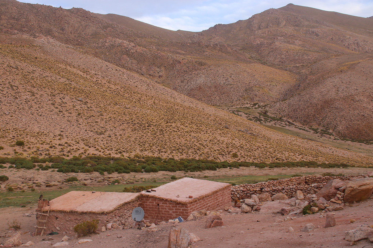
we decided to wait, there was water, and we could open the unlocked door to the kitchen where we made a fire. This puesto was the hill side close to a water spring
at the edge of a huge dry dusty plane, with no one around!
Puesto perdido, where we got separated from the donkeys and waited for a few hours with mate. |

View from the puesto perdido to the plains, infinite, dusty and dry. |
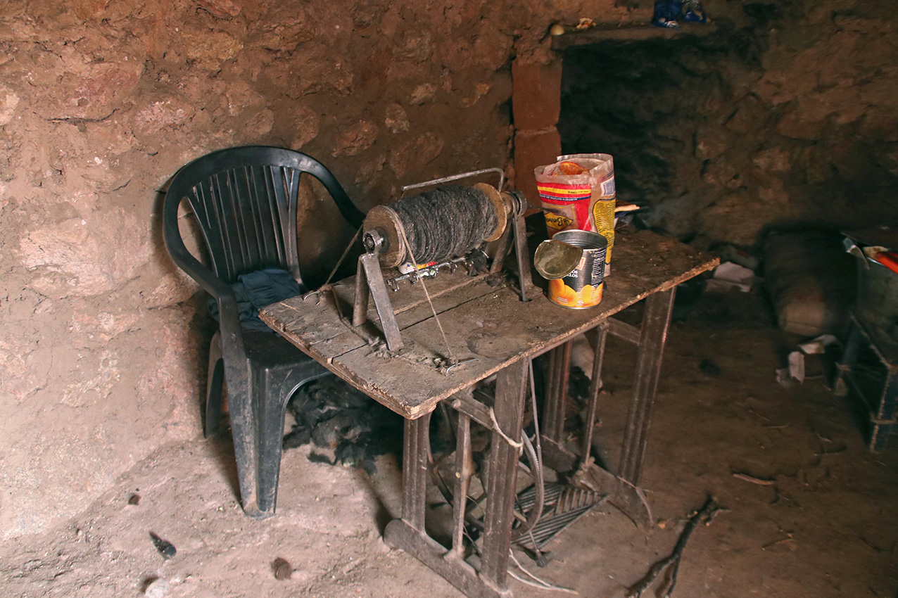
Puesto perdido: kitchen house with spinning machine, there was a pile of raw llama wool on the floor beside it. This was a dirty place with a pot of greasy pasta stew, a bar of llama fat, a piece of meat and recently baked round tortillas (bread). The puesto was shut when we arrrived and noone there. We opened the door, started a fire to heat up the mate water, and scarred the teenage girl and younger boy when they returned. They were the caretakers of the llamas around the place. |

Kitchen house, bar of white greasy llama fat on the top shelf. |

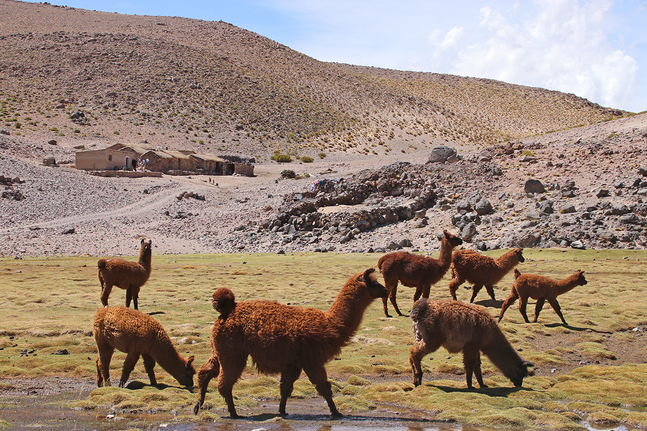
Llama. |
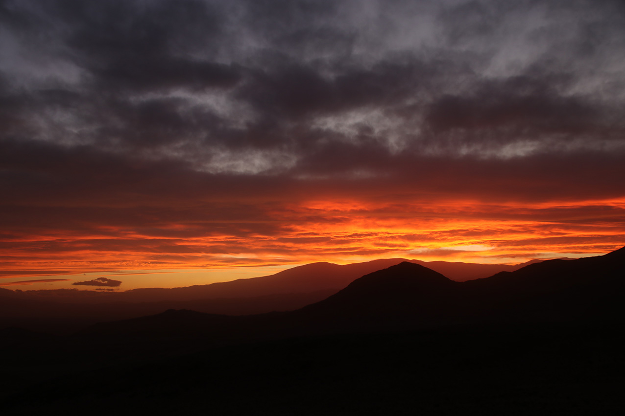
Sunset in the last stretch to fourth night camping ground by a stream and corral. |
Clouds |
Puesto before Aguas Calientes |
Arriving at Aguas Calientes |
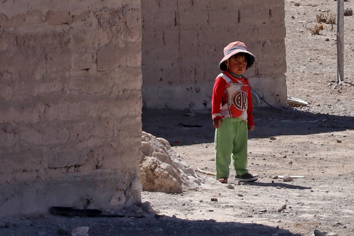
Toddler |

Some people in this indigenous community speak Quechua |
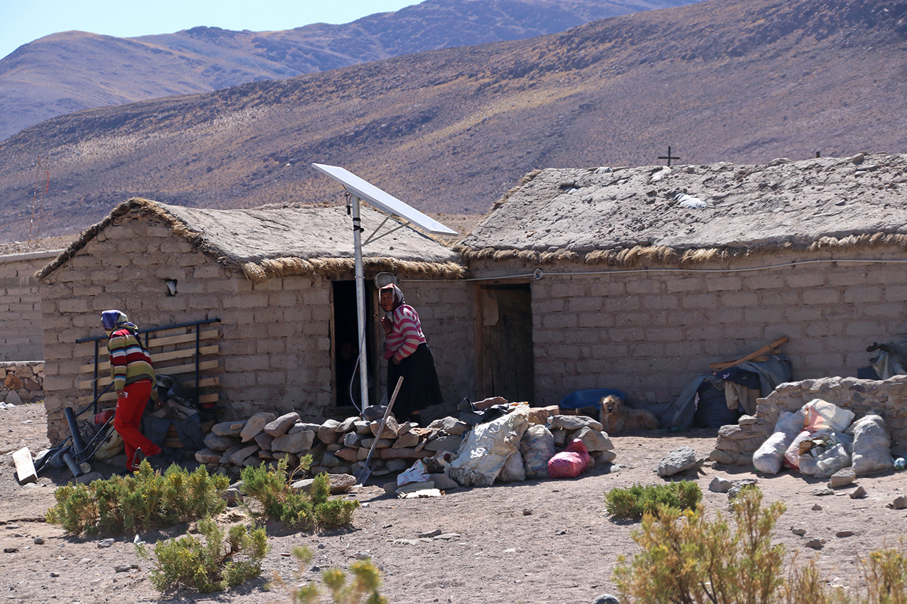
Houses and people |
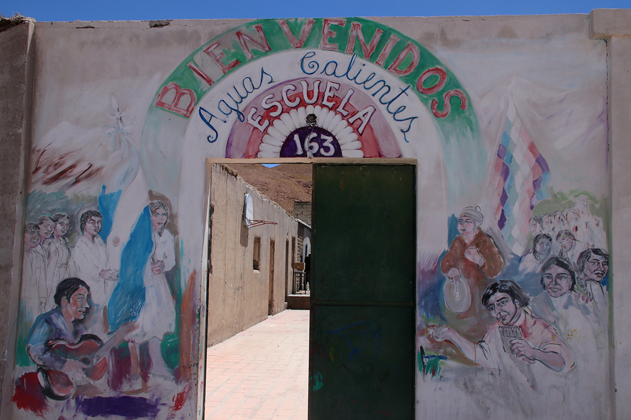
Old school entrance (notice the narrowly enclosed compound that blocks the high winds). There is a new school building in town. |

School kids saluting the flag at the start of a school day. |
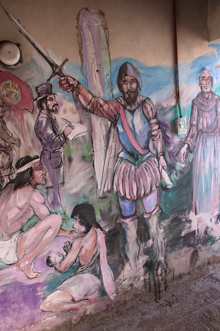
Wall painting in old school: extraordinarily ironic motif in an indigenous community. |
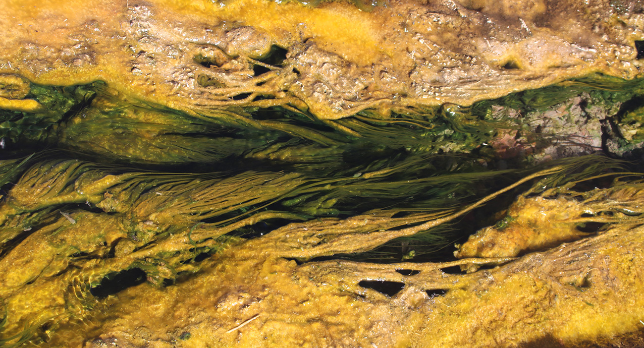
Extremophiles growing in the hot waters that give its name to Aguas Calientes. |
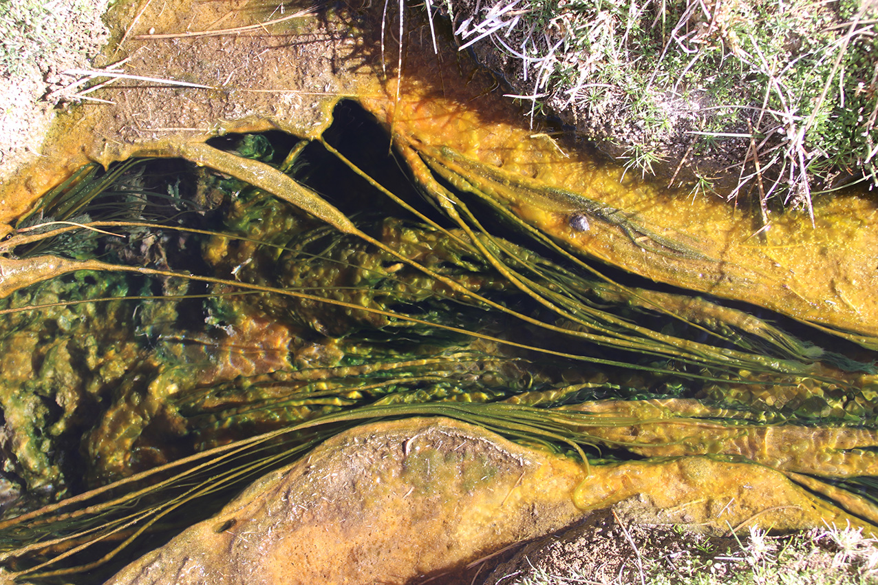
Extremophiles growing in the hot waters that give its name to Aguas Calientes. |
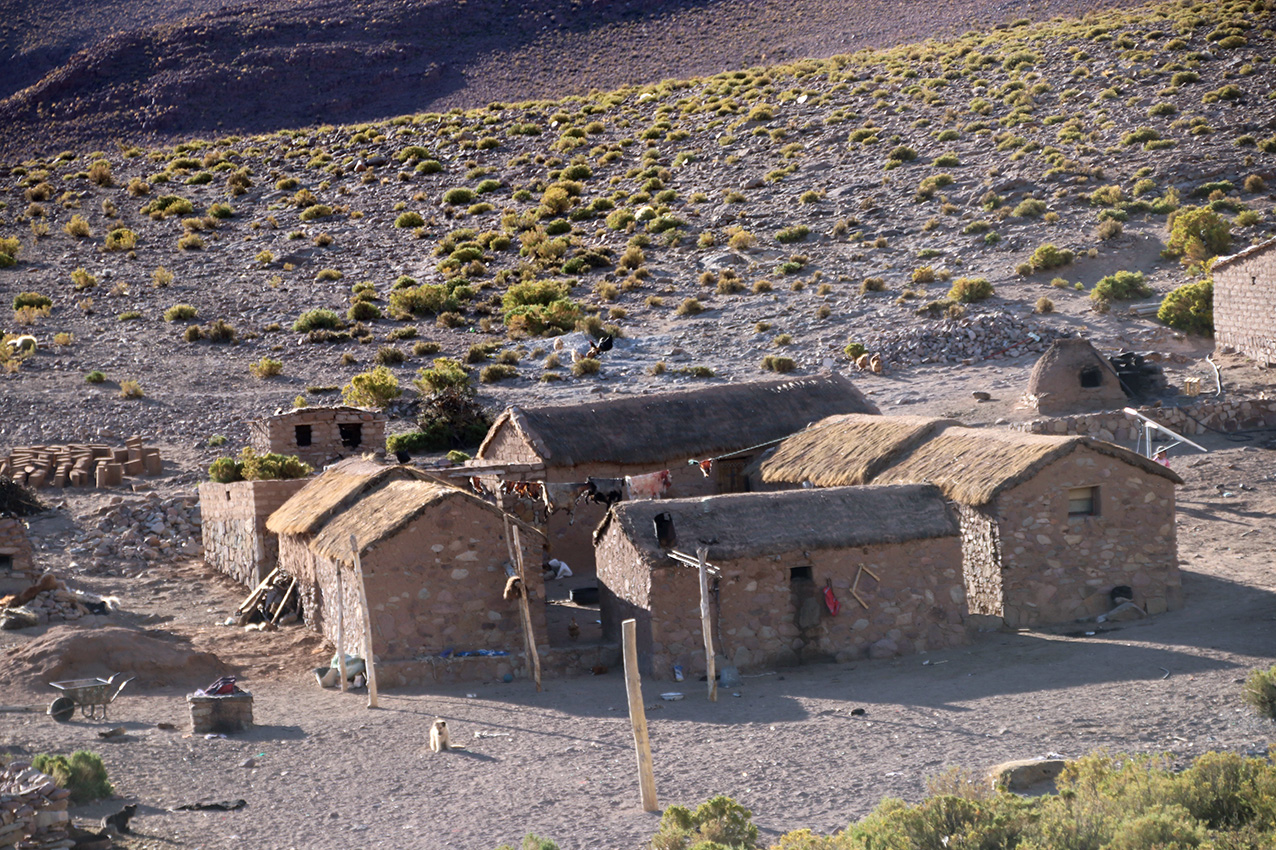
Cacique's household outside Aguas Calientes. |

Children. |
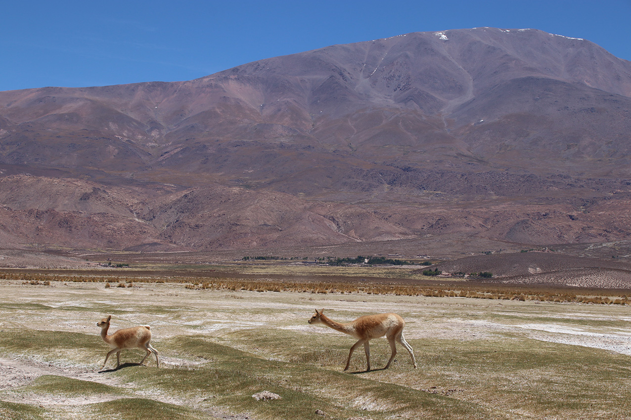
Vicuna with the mountains west of Laguna Grande village at the back |
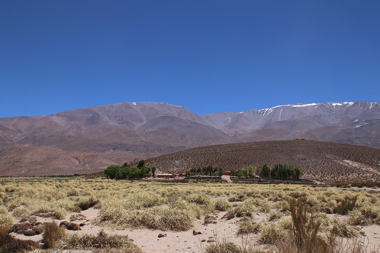
Farmhouse close to Laguna Grande with mountains above 5000m in background. |
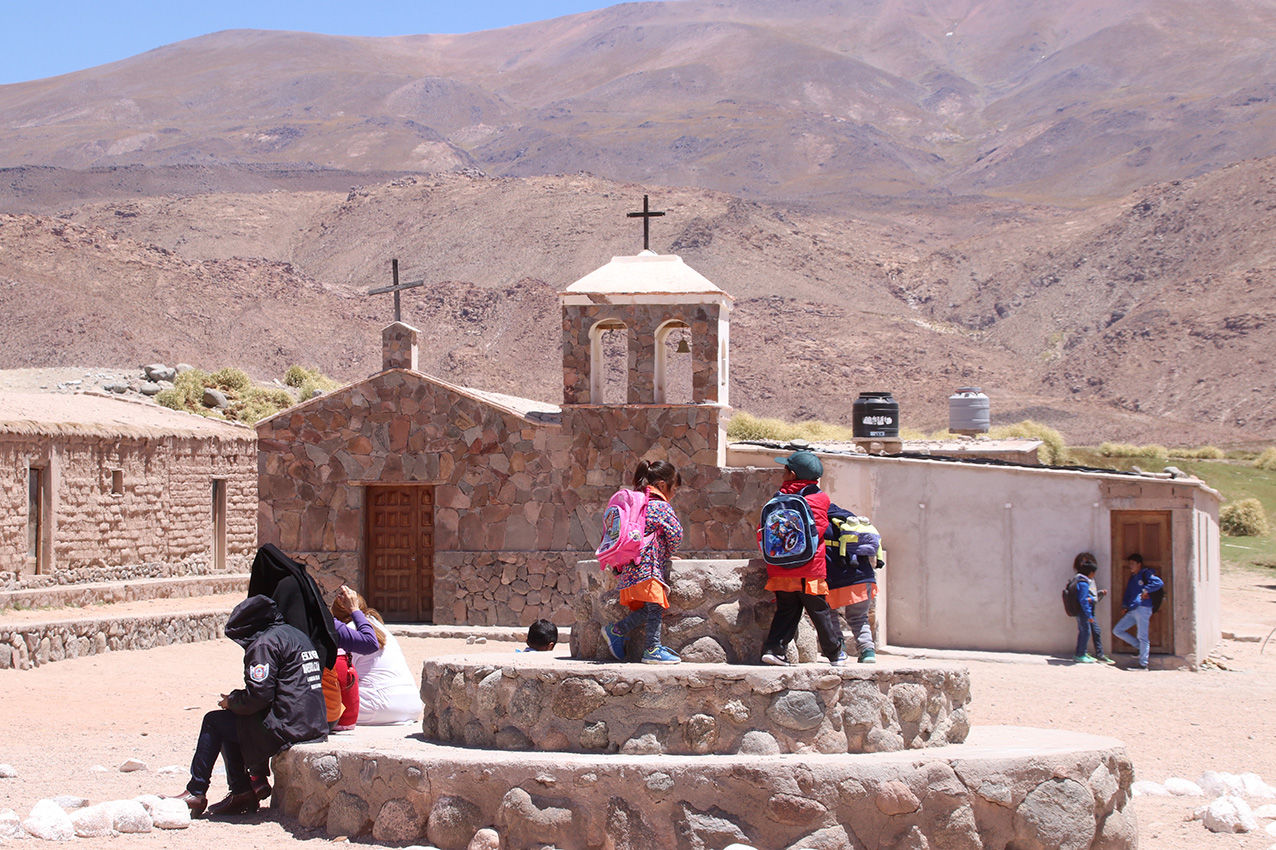
Church and children in Laguna Grande village |

Road to El Penon |
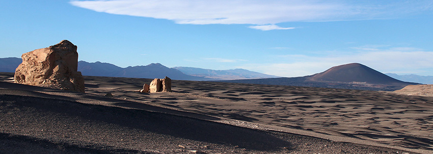
Campo de Piedra Pumez, Cerro Blanco |
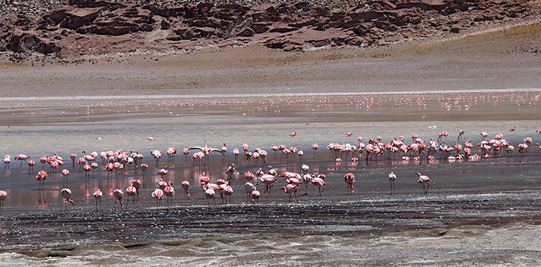
Laguna Grande: flamingos |
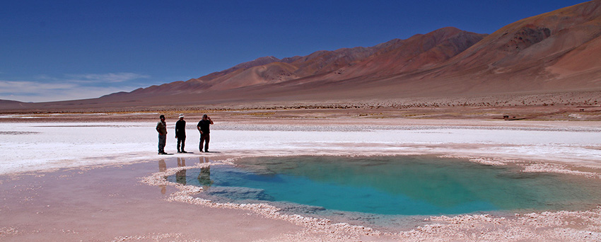
Ojos del Mar, Salta: stromatolites and extremophiles |