

Paul R. Houser, NASA/GSFC Hydrological Sciences

Paul R. Houser, Page 29 7-Jun-01

Objective: A 1/8 degree (~10km) global land
modeling and assimilation system that uses all relevant observed forcing, storages, and
validation.
Expand the current N. American LDAS to the globe. HPCC!!! 1km global resolution goal
Benefits: Enable
improved land-atmosphere understanding,
hydrological and climate prediction, transfer
research to application, and enable consistent
inter-site comparison (I.e. GEWEX).
Open Collaboration: Encourage international participation through code and data access, and cooperative evaluation.
Coupled Connections: GLDAS is the off-line land-surface development strategy for DAO, NCEP,
NCAR, and NSIPP.
GLDAS Data Sources: DAO(GEOS), NCEP(GDAS), and ECMWF NWP “base” forcing.
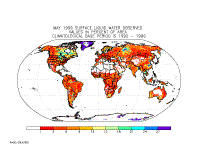
Force with Observations: IR, TRMM, and SSM/I Precipitation, Geostationary Insolation.
Assimilation and Validation: GTS, IR derived Surface Temperature, AMSR/TRMM Soil Moisture, MODIS
Snow Cover, GRACE total water storage change.


![[NOAA]](slide0080_image276.gif)
Paul
R. Houser, NASA/GSFC
Hydrological Sciences
Paul.Houser@gsfc.nasa.gov
Observed Forcing
Consistent Global
Intercomparison
Land Data
Assimilation


CEOP