|
Building detection and 3D roof reconstruction using LIDAR data
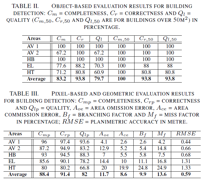
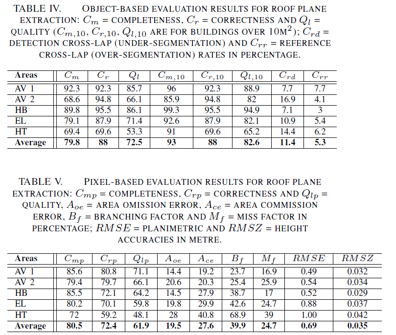
A new roof extraction algorithm has recently been developed and submitted to the theme Issue on Urban Object Detection and 3D Building Reconstruction of the ISPRS Journal of Photogrammetry and Remote Sensing. Objective evaluation results on the Vaihingen data set is available online. For results by the proposed method look for Mon_13 method. This results were generated by the evaluation system in Rutzinger et al. [1]. Results on the remaining data sets were evaluated using the automatic and threshold-free system in Awrangjeb et al. [2]. These objective evaluation results are given below. For data sets to use for research purposed only please send me an e-mail. |
|
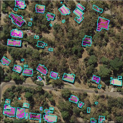
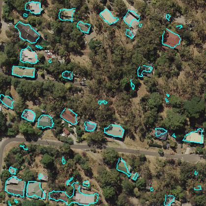
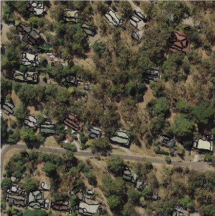
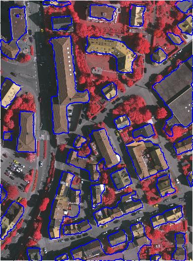
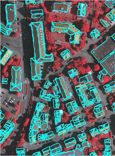
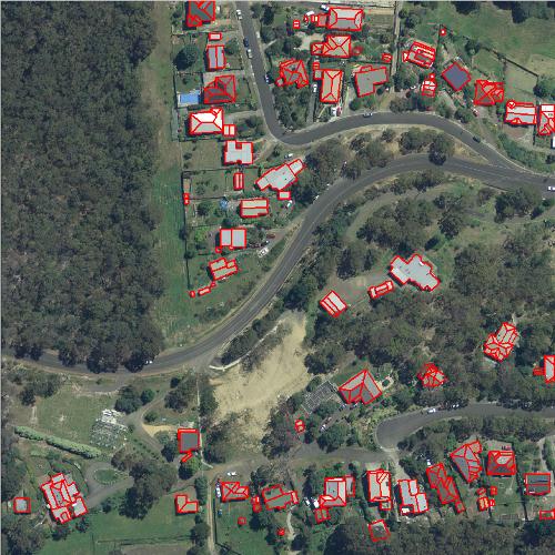
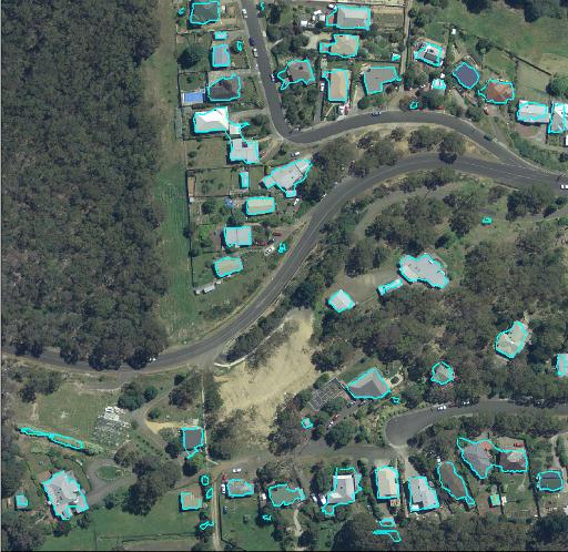
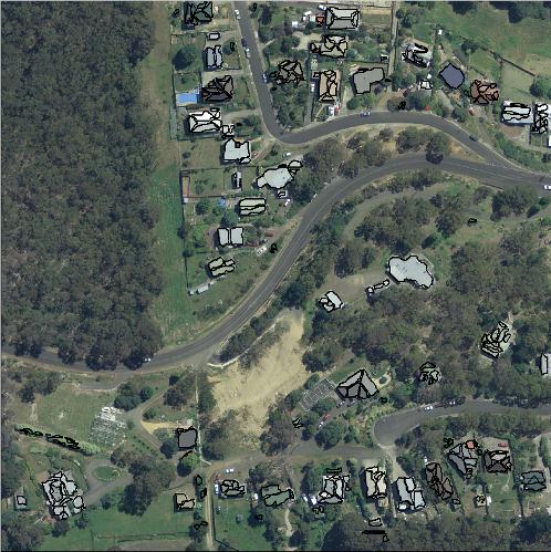
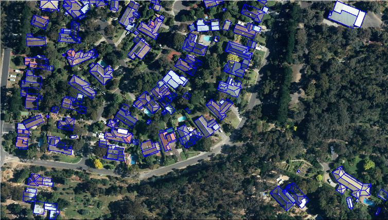
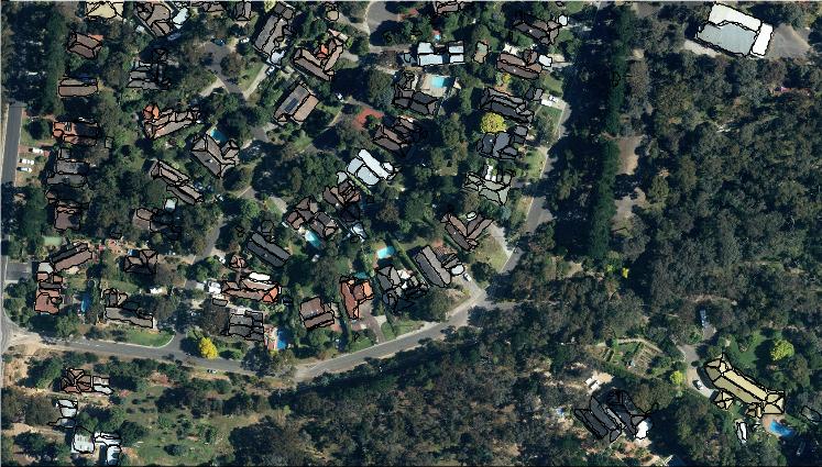
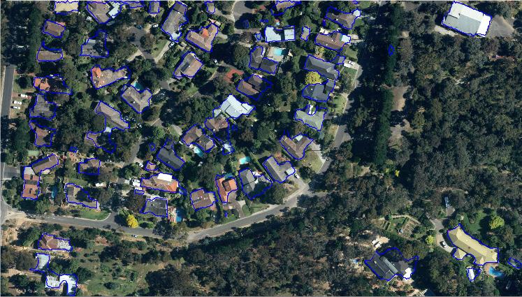
Results: See Tables II to V above. A) Vaihingen Area 1 (left to right: reference data, building detection, roof extraction) (Data used: LIDAR point cloud 3.5 points/m2) |
|
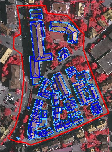
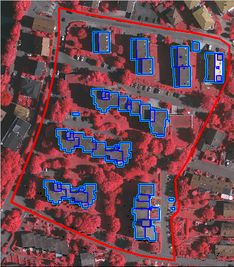
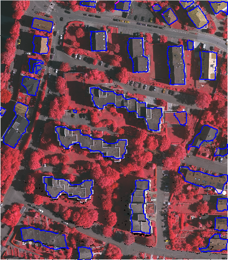
B) Vaihingen Area 2 (left to right: reference data, building detection, roof extraction) (Data used: LIDAR point cloud 3.9 points/m2) |
|
C) Vaihingen Area 3 (left to right: reference data, building detection, roof extraction) (Data used: LIDAR point cloud 3.5 points/m2) |
|
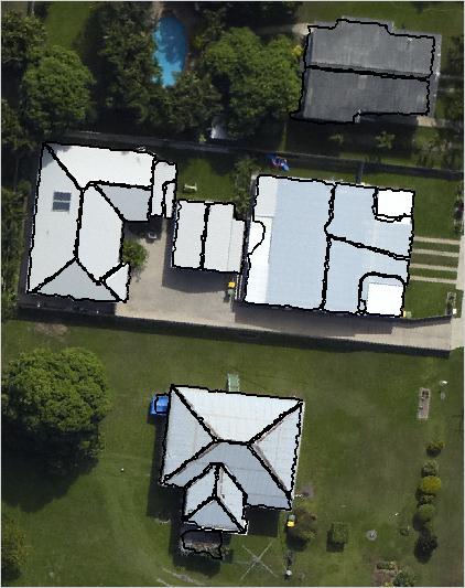
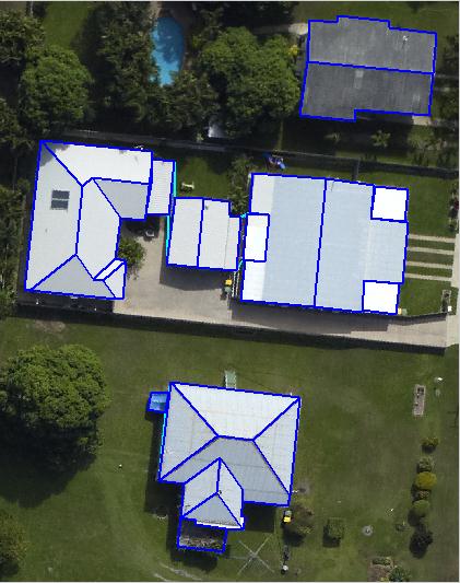
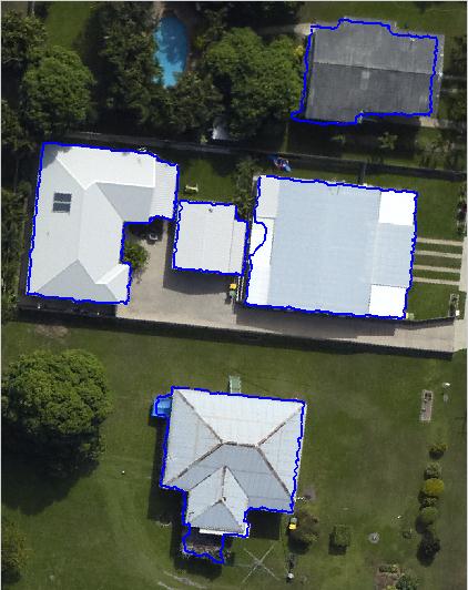
D) Aitkenvale Area 1 (left to right: reference data, building detection, roof extraction) (Data used: LIDAR point cloud 40 points/m2) |
|
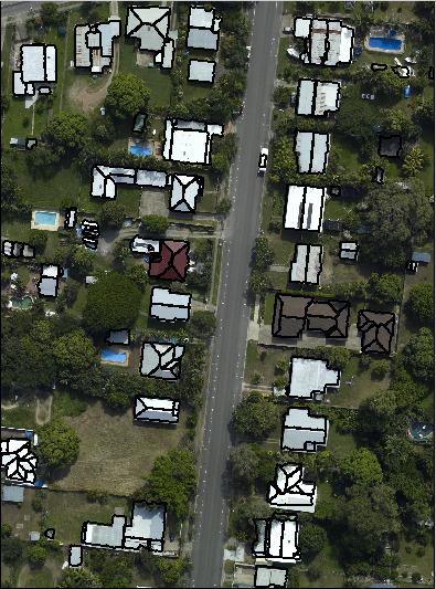
E) Aitkenvale Area 2 (left to right: reference data, building detection, roof extraction) (Data used: LIDAR point cloud 29.3 points/m2) |
|
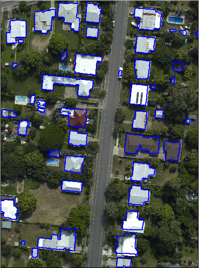
F) Hervey Bay 1 (left to right: reference data, building detection, roof extraction) (Data used: LIDAR point cloud 12 points/m2) |
|
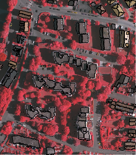
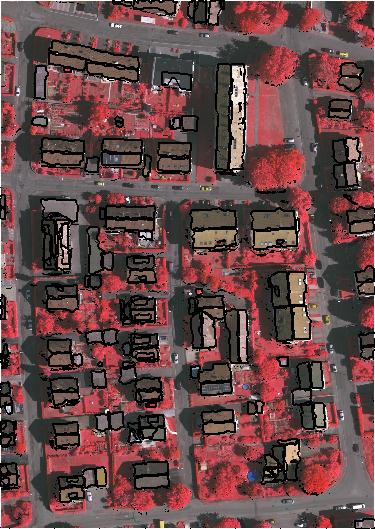
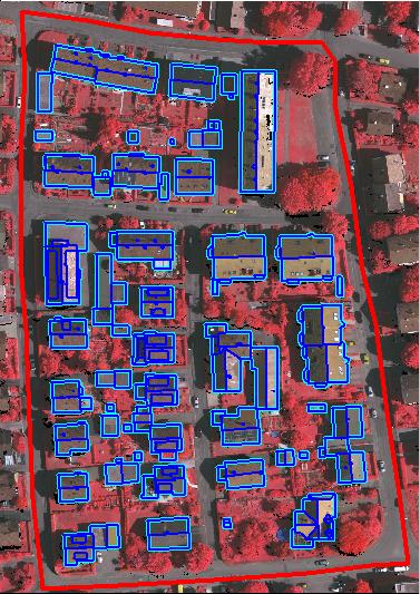
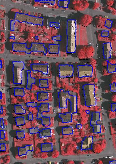
H) Eltham (left to right: reference data, building detection, roof extraction) (Data used: LIDAR point cloud 4.8 points/m2) |
|
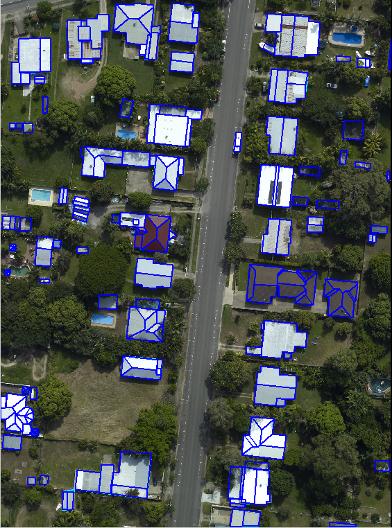
G) Hobart (left to right: reference data, building detection, roof extraction) (Data used: LIDAR point cloud 1.6 points/m2) |
|
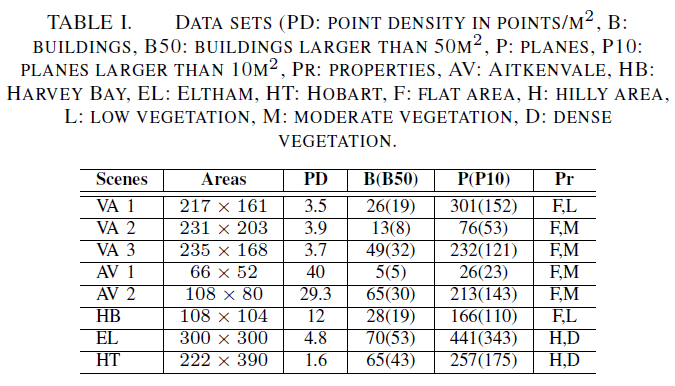
Data sets: See Table I below (VA = Vaihingen, AV = Aitkenvale, HB = Hervey Bay, EL = Eltham and HT = Hobart) |
|
References: 1. Rutzinger, M., Rottensteiner, F., Pfeifer, N., 2009. A comparison of evaluation techniques for building extraction from airborne laser scanning. IEEE Journal of Selected Topics in Applied Earth Observations and Remote Sensing 2~(1), 11--20. 2. Awrangjeb, M., Ravanbakhsh, M., Fraser, C. S., 2010. Building detection from multispectral imagery and lidar data employing a threshold-free evaluation system. International Archives of the Photogrammetry, Remote Sensing and Spatial Information Sciences 38~(part 3A), 49--55. |
|
H) Knox (left to right: reference data, building detection, roof extraction) (Data used: LIDAR point cloud 1.2 points/m2) |